RPGMapEditor.com 2.0 adds World Studio: a browser-based fantasy world map editor where you generate a continent, sculpt its terrain, and let rivers, lakes and realm borders respond to your changes. It joins the Classic tile editor in the Online Edition, giving you tools for both the campaign's big picture and the places where individual encounters happen.
You can create an island kingdom, raise the mountain range that divides it, move its capital, plan the party's journey across it, and reveal the map through fog of war. The geography remains editable throughout. When you need a town square, dungeon or forest encounter, the Classic editor handles tile layers, selections, objects and your own tilesets.
This guide covers the features, the practical workflow, the two editions, and how RPGMapEditor.com 2.0 compares with Inkarnate, Wonderdraft, Azgaar's Fantasy Map Generator, Dungeondraft, DungeonFog and Watabou's generators. It also explains the limits that matter before you choose a mapmaking tool.
Explore World Studio · Compare editions and current pricing · Try the free map generators
The essential distinction: World Studio makes editable geographical world maps. The Classic editor makes editable tile maps. Both are available with the Online Edition, but their project formats are separate. World Studio is not included in the one-time Offline Edition.
What is new in RPGMapEditor.com 2.0?
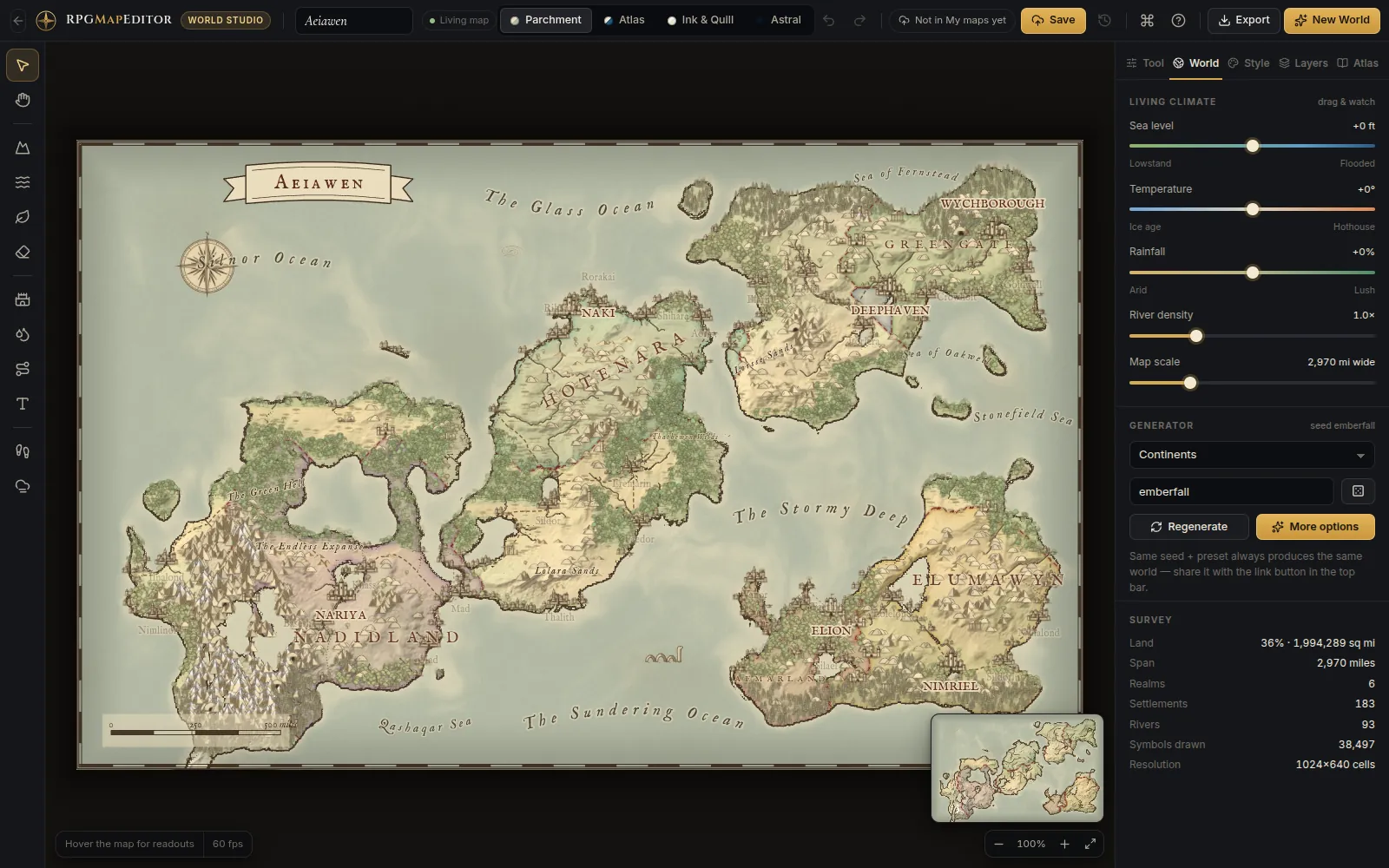
The main addition is World Studio, a second editor designed for continents, regions, islands and kingdoms. Its terrain, climate, waterways, settlements, roads and labels provide a foundation you can reshape after generation. You are not limited to accepting the first result or repainting every consequence of an edit by hand.
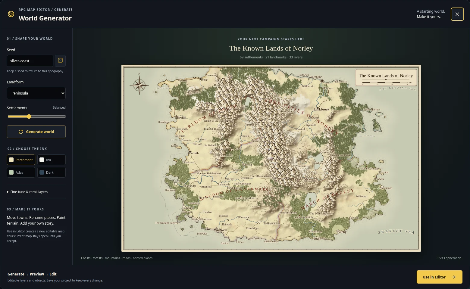
A typical session starts with a preset and a seed. The generator creates the land, models its climate, lays out waterways, places settlements and develops realms and routes. You then decide what your campaign needs: a mountain pass, a flooded coast, a dry interior, a ruined fortress or a new capital.
The release connects this editor to your account's map library. Cloud saves have version history, older saves can be restored, conflicting changes get explicit choices, and browser drafts help recover unfinished work. The tools for using a world during play include journey planning, a travel grid, fog of war and a separate Player View.
| Part of the platform | What it is for | What happens to the result |
|---|---|---|
| World Studio | Campaign geography, continents, regions and kingdoms | Keep editing the world; save cloud versions; download a .rpgmap project or PNG |
| Classic tile editor | Encounter maps, dungeons, towns and game tilemaps | Edit tile layers and objects; save a portable project; export PNG or an experimental engine starter |
| Free public generators | Getting a city, region or dungeon idea quickly | Generate without an account; use the available exports or the supported editor handoff |
| Offline Edition | Local Classic tile projects on a desktop computer | Save projects on your disk and work offline after activation |
RPGMapEditor.com is an independent product. This release is not an update to Deepnight's RPG Map / RPG Map II. If that is the tool you were looking for, our RPG Map Editor 2 naming guide explains the distinction.
Generate a world with six presets and reproducible seeds
World Studio's six presets give you different starting geometries. Choosing one around the campaign you want to run is usually more useful than generating a completely random continent and trying to force the story into it afterward.
| Preset | Starting geography | A campaign it can support |
|---|---|---|
| Continents | Several major landmasses across a world | Distant empires, ocean crossings and a broad campaign setting |
| Pangaea | One large supercontinent | Long overland journeys and connected political powers |
| Archipelago | Scattered islands | Sailing, island exploration and competing ports |
| Island | One island realm | A contained campaign with a coastline players can learn |
| Highlands | Mountains, valleys and lakes | Passes, isolated settlements and difficult land travel |
| Inland Sea | Land and coasts around an enclosed sea | Coastal trade, rival ports and routes around a shared waterway |
The New World dialog includes live preset previews generated from your seed. You can see the direction of a world before committing to it, then adjust the generation options rather than treating the preset as a fixed picture.
Small, medium and large worlds
The current sizes are Small: 768 × 480 cells, Medium: 1024 × 640 cells, and Large: 1536 × 960 cells. Medium is the recommended starting point. Small is useful for a focused setting or quicker experimentation; Large provides more geographical detail and asks more of your computer.
These are the world's underlying field dimensions. An exported image can be larger because PNG export renders at a selected multiple of the map resolution. Increasing export size and increasing the size of the editable world solve different problems: one affects the image you deliver, while the other affects the geography you work on.
What a seed preserves
A seed makes generation reproducible when you use the same generation settings. Keep the seed and settings in your campaign notes when you want to return to the same starting geography. Seed links are convenient for sharing a starting point.
A seed link does not preserve your later edits. Once you have moved a capital, drawn a custom road, renamed places or changed the terrain, save the world to your account and download its .rpgmap project when you need a portable copy. The project is the record of your authored world; the seed describes its generated beginning.
Generation is procedural. World Studio builds terrain, climate, names and cartographic features from rules and seeded variation, rather than charging for AI image generations. You can keep editing the geographical fields and individual objects that produced the visible map.
Living terrain: sculpt the land and see the geography respond
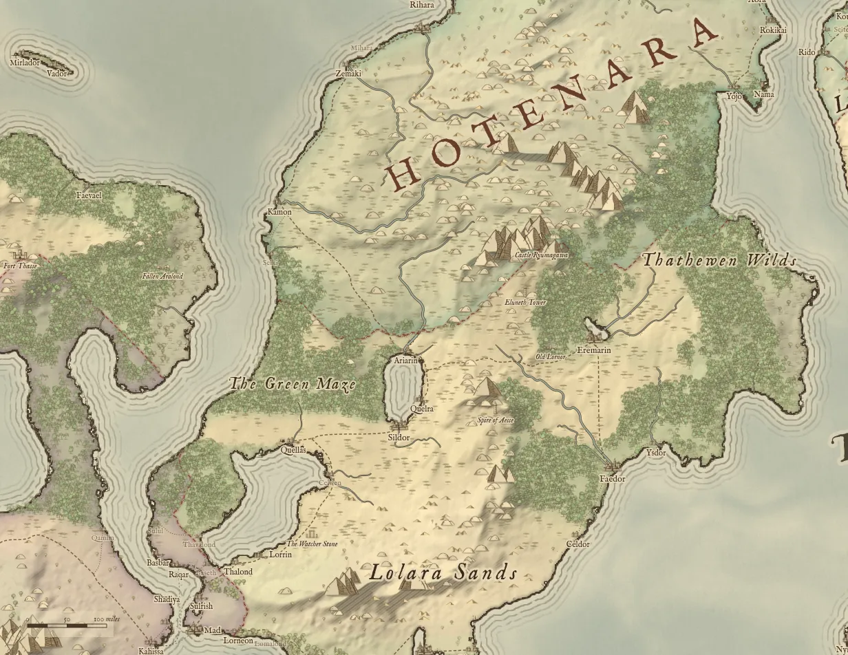
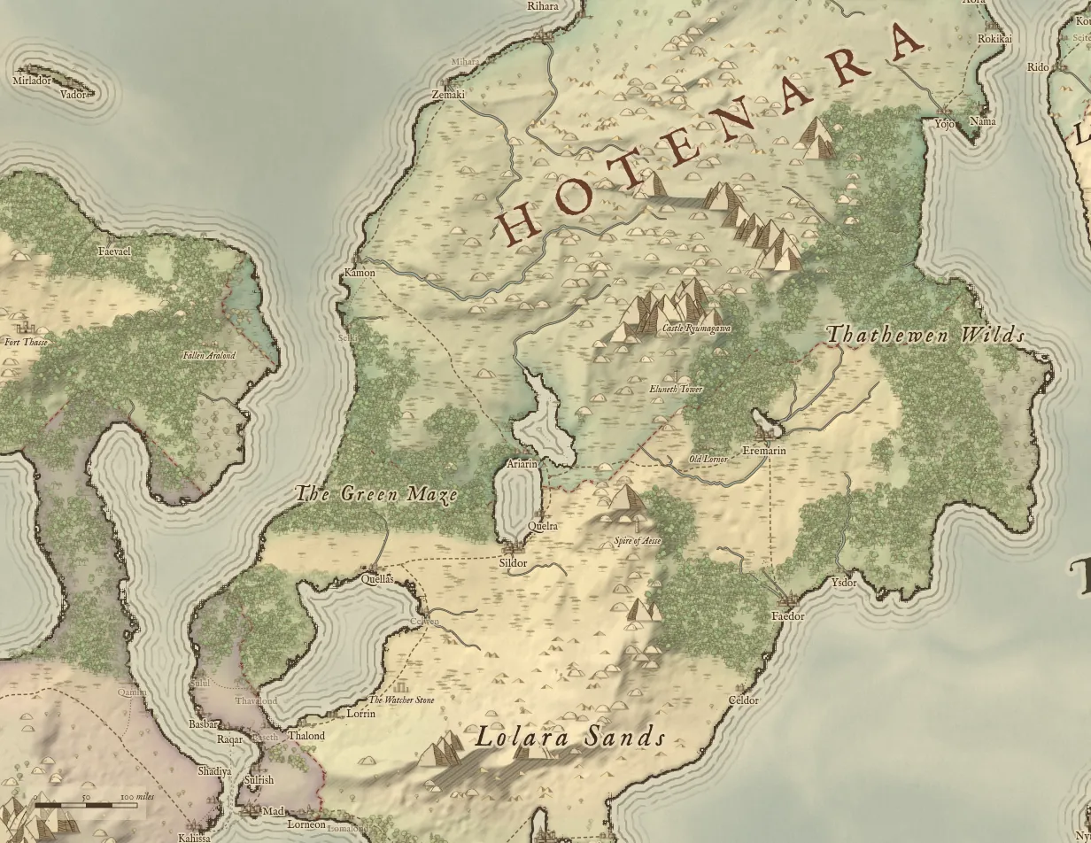
World Studio's central feature is the relationship between what you change and what the map recalculates. Elevation, moisture, temperature and authored places form the editable foundation. Waterways, lakes, terrain decoration and realm territories are derived from that foundation.
This makes a terrain edit useful beyond its appearance. A ridge can redirect drainage or cause water to collect. A change in sea level can redraw the coastline. Moving a capital changes the starting point from which its realm territory is calculated. The result gives you consequences to build a story around.
The map is a fantasy cartography model, rather than a scientific forecast of a planet's geology or weather. Its purpose is to help you make geography that responds consistently enough to support creative decisions.
Raise, lower, smooth, flatten, roughen and weather terrain
The Sculpt tool offers six brush operations. Raise and lower change the height of the land. Smooth softens rough features. Flatten helps create a more even area. Roughen adds variation. Weather applies local erosion to reshape a slope.
That is enough to work at several scales. Raise a dividing mountain range, lower a crossing through it, smooth the approaches, then roughen an isolated upland. You can change the brush size as you work, making broad alterations before refining the part of the map the party will actually visit.
The value is in experimentation. Your first mountain pass may be too easy to reach, or the first coastline may leave a settlement in an awkward position. Undo lets you compare alternatives without accepting every stroke as permanent.
Rivers, lakes and custom waterways
Generated rivers and lakes follow the world's terrain and hydrology. You can also use the Rivers tool to preview where water would run, carve a route, or draw a river freehand when the setting calls for a deliberate authored feature.
That combination helps with both natural-looking geography and fantasy exceptions. Start with the generated drainage, inspect the route through a valley, then add the waterway that serves your story. A sacred canal or an unnatural river does not have to be justified by rerolling the entire world.
The river-density control changes how readily rivers appear. Use a quieter network when you want a clean overview, or a denser one when waterways and crossings are central to the campaign. Local terrain edits then give the individual river system its shape.
Sea level, temperature and rainfall
Three live controls let you change the world more broadly. Sea level alters which parts of the terrain are submerged. Temperature shifts climate toward colder or warmer conditions. Rainfall changes the world's moisture balance.
For a campaign designer, these controls are story tools. Explore a coast before and after a flood, turn a route into a harsher crossing, or try a wetter version of the same region. Save versions you want to keep so the experiment does not replace the campaign's established geography.
The climate pipeline also accounts for terrain and rain shadows during generation. Biome painting works through climate fields, so it is useful to think in terms of encouraging a forest, desert or other biome through the conditions that support it.
The complete World Studio toolset
World Studio brings terrain editing, cartographic objects and table tools into one workspace. Single-key shortcuts make it possible to switch tasks while keeping your attention on the map. The tool rail and command palette provide another route to the same work.
| Tool | Shortcut | What you can do |
|---|---|---|
| Select and move | V | Select places and objects, move them, inspect information and refine positioning |
| Pan | H | Navigate the map without changing it |
| Sculpt | B | Raise, lower, smooth, flatten, roughen or weather terrain |
| Land and sea | L | Paint the shape of land and water |
| Biomes | P | Paint climate fields to influence forests, deserts and other biomes |
| Decor | E | Clear or restore procedural terrain decoration |
| Landmarks | S | Place and vary settlement, adventure and decorative symbols |
| Rivers | R | Preview flow, carve waterways or draw an authored river |
| Roads | O | Plan routes using terrain-aware pathfinding |
| Labels | T | Add, style and curve map labels |
| Journey | M | Plan a route and estimate travel distance and time |
| Fog of war | F | Reveal or conceal areas for the Player View |
Twenty landmark kinds, editable names and GM notes
The landmark selection includes capital, city, town, village, castle, tower, ruins, temple, cave, port, camp, lighthouse, monolith, ship, serpent, whirlpool, compass, skull, mine and windmill. That covers settlements, adventure locations and the symbols that give a fantasy chart its character.
You can change names, move selected places, choose landmark variants, adjust their scale and keep notes. A ruined tower can become the location of next week's session; a port can hold your notes about its rival merchant families. The map stays useful as a campaign reference after its visual layout is finished.
The gazetteer provides procedural place information and adventure hooks. Treat that material as a starting point for your own setting. It can suggest a trade, ruler or local problem, while your notes define what is true in the campaign you actually run.
Roads, sea lanes and realm borders
Road drawing uses terrain-aware pathfinding and can reuse existing road routes. That helps you connect settlements without sketching every bend yourself. Use the route as a starting point, then judge it against the needs of your world: which bridge matters, where tolls are collected, and which pass becomes inaccessible in winter.
Realms are another geographical layer. Their territories respond to the locations of their capitals and to the terrain around them. Moving a capital is therefore a way to explore a political layout, rather than merely moving a label over an unchanged border.
This does not turn the editor into a diplomacy or economic simulator. It gives you editable political geography that can support those ideas in your campaign notes.
Curved labels and independent visibility layers
Labels can identify realms, water, mountain ranges, forests, regions and custom features. Curving and styling a label helps it follow the geography instead of sitting as a rectangular annotation over it.
Visibility controls let you show or hide biome colour, coastal ripples, rivers, roads and sea lanes, realm borders, forests and mountains, places and landmarks, labels, the frame and scale bar, and the travel grid. Hide visual detail for a clean player handout, or expose more layers when you are planning the campaign.
These World Studio visibility layers are cartographic display controls. The Classic editor's tile layers are a different kind of editable map structure; the two systems should not be confused when you choose how to build a map.
Navigation, search and everyday shortcuts
The minimap helps you keep your place while zoomed in. The command palette, opened with Ctrl+K, searches commands and place names. It is especially useful after the world has enough settlements that finding a particular town by sight becomes tedious.
Use Space+drag to pan from another tool, the mouse wheel or pinch to zoom at the cursor, and Shift+1 to fit the map. Bracket keys change brush size. Ctrl+Z undoes an edit, Ctrl+Shift+Z redoes it, Ctrl+S saves, and Ctrl+E opens export. The in-app shortcut reference provides the full set.
Four map styles without rebuilding the world
World Studio includes Parchment, Atlas, Ink & Quill, and Astral. You can switch styles with the style controls or the 1–4 keys. The same geography, settlements and roads remain in place while the map's visual treatment changes.
Parchment is a natural starting point for a fantasy campaign handout. Atlas supports a clearer geographical overview. Ink & Quill provides a more restrained ink treatment. Astral gives the same world a different, more otherworldly presentation. Choosing a style around the intended use is more productive than treating one style as universally best.
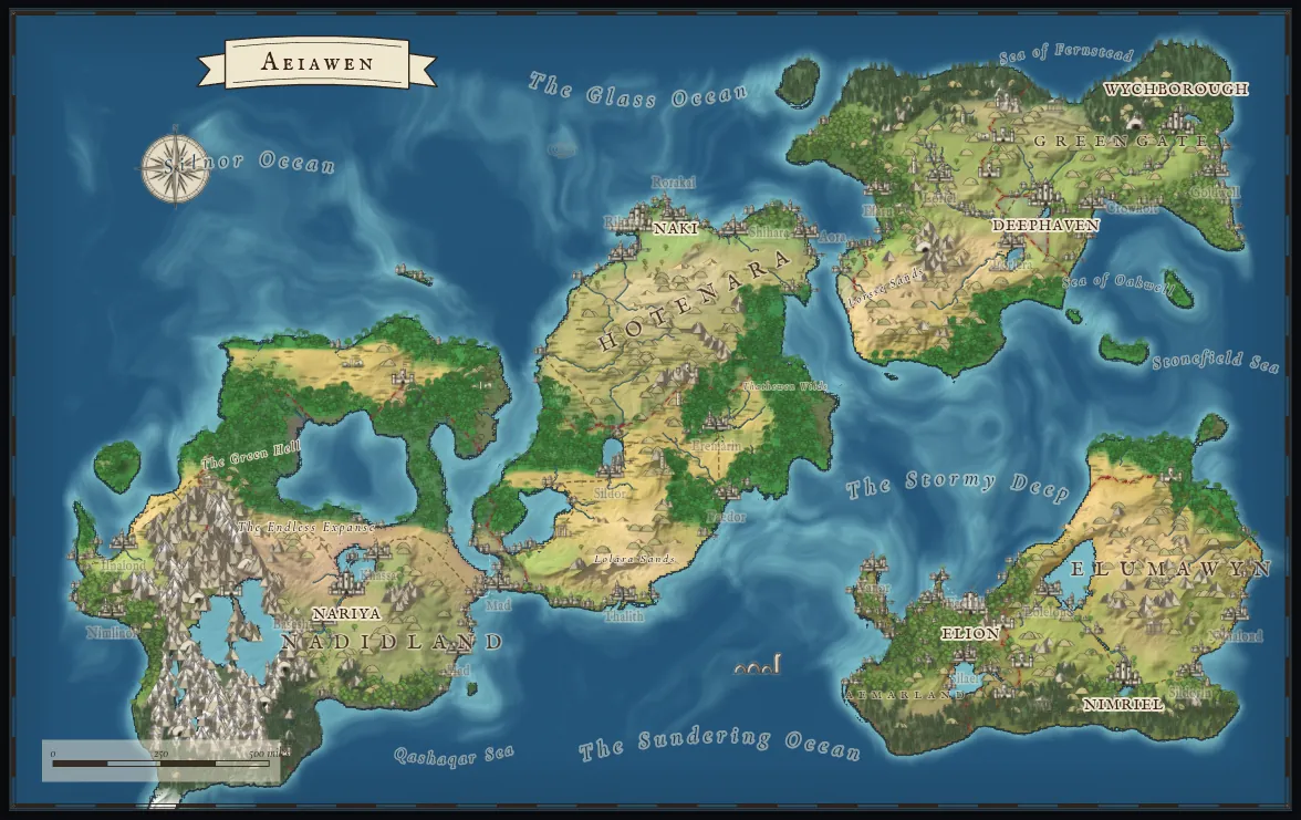
Beyond the preset, you can adjust sun direction, relief shading, engraved hatching, coastal ripples, paper age, colour saturation, realm tint and symbol size. These controls make it possible to reduce visual noise, improve the prominence of landforms, or tune a handout around the character of a setting.
Use the light direction to make a ridge easier to read. Reduce realm tint when political divisions are distracting. Increase symbol size when settlements are too small at the scale you plan to print. Hide labels or the grid when you want an illustration, and restore them when the map is needed for navigation.
Changing the visual treatment is different from regenerating the world. You can explore a presentation choice without losing the authored places that made the map yours.
Use the world during play: journeys, grids and fog of war
A campaign map needs to answer practical questions. How far is the ruined city? Which route avoids the mountains? What do the players know about the next valley? World Studio includes tools for those questions alongside the drawing controls.
Journey planning with distance and travel estimates
The Journey tool finds a route between places and shows distance, estimated days on foot and horseback, and a terrain breakdown. The map-scale control determines how wide your world is in miles, so set a scale that makes sense before treating the travel estimates as useful campaign information.
The route can become a preparation outline. If a trip crosses several kinds of terrain, place encounters where the geography changes: the last settlement before the pass, the approach to a river crossing, or a campsite near an exposed ridge. The map provides the route; you decide how the game rules and story affect the journey.
The displayed days are planning estimates, not an automatic application of every tabletop system's movement rules. Adjust for the party's pace, weather, transport and other conditions at your table.
Hex and square travel grids
Choose a hex or square grid and adjust its cell size for the scale of the campaign. A small travel cell can help with local exploration, while a larger cell can support a realm-wide overview.
Keep the grid useful to the players. A grid that is too dense can obscure roads and labels; a grid that is too coarse can hide the distinction between nearby routes. Because the grid is a visibility layer, you can keep it for planning and omit it from an illustrative export.
Fog of war and a separate Player View
Paint fog of war in your editing workspace, then open the Player View in another window. It displays the areas you reveal and updates as you paint. Names anchored in hidden areas are concealed, helping you reveal geography without exposing every place name at the start of the campaign.
This is useful with a second display or a screen share of the Player View window. Share that window rather than your editing workspace, where tools and GM information remain visible. Keep your own campaign notes in the editor and reveal only the map information the players should see.
Player View is a map presentation tool. It is not a multiplayer editing session, a token-based combat system, or a complete virtual tabletop with character sheets and dice.
Cloud saves, version history and browser recovery
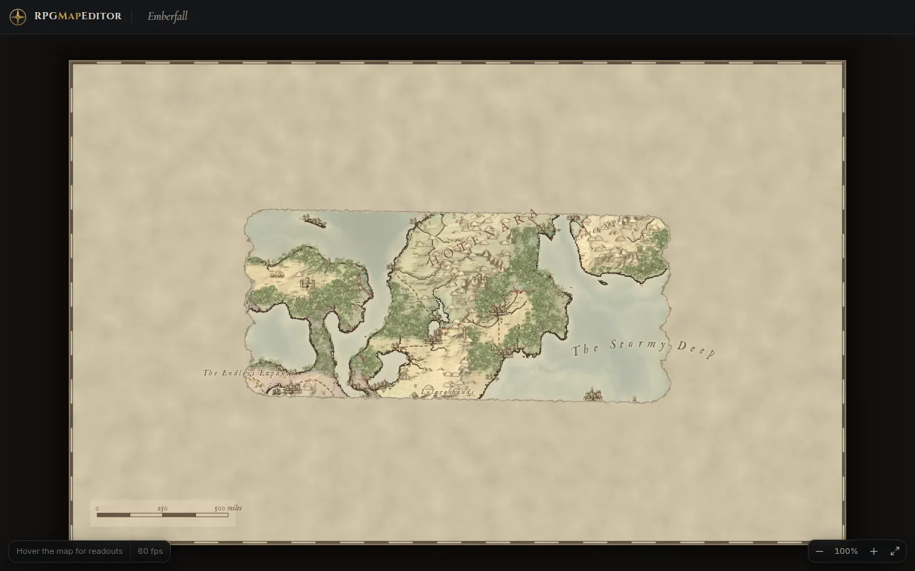
World Studio's account integration is designed around the fact that a campaign world changes over time. You may want the map before a war, after a flood, or before you experimented with moving an important city. Saving a world should not make those earlier states disappear without a choice.
Save to My maps and keep earlier versions
Use Save or Ctrl+S to save a world to My maps. Cloud autosave also runs after about 45 seconds without edits. The save-state indicator helps you distinguish a world that is saved from one with changes still waiting to reach the server.
The default history keeps the latest 20 saves per world. You can download retained versions individually. Restoring an older version adds a new head version, preserving the history instead of replacing the older record in place.
For an established setting, save meaningful milestones deliberately. A cloud save before a major geographical experiment is easier to identify than relying entirely on the timing of autosave. A downloaded project gives you another copy outside the account's cloud history.
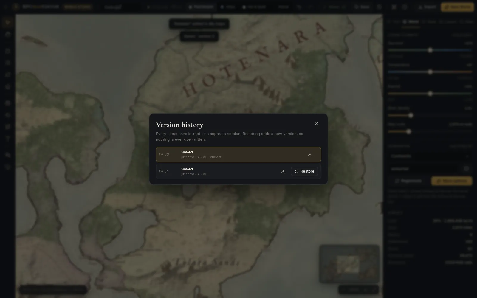
Resolve a two-tab conflict explicitly
If another tab or device saves a newer version while you are editing, World Studio detects the conflict. You can save your work as a copy, replace the current head with your version, or reload the newer version. The conflict flow also offers a way to download your work before choosing to reload.
That is protection against accidental overwriting, not collaborative live editing. Two people editing the same world should still coordinate their work. Version history and conflict choices help recover from a clash; they do not merge every independent terrain edit automatically.
Browser drafts and save-before-replace guards
Unsaved changes are mirrored into a browser draft and can be offered back when you reopen the world. Draft storage is separate from the Classic editor's browser storage, so the two editors do not use the same draft database.
A browser draft usually lands about three seconds after the last edit. That short delay matters: closing the tab immediately can lose the newest seconds of work. The leave-page warning, the save-state indicator and an explicit Save before leaving are useful safeguards.
New World and Open also protect work that would be replaced. These guards let you decide what to do with your current changes before moving to another document. A recovered draft is a chance to continue unfinished work, rather than a promise that every edit has already been backed up to the cloud.
World limits, deletion and cancellation
The current default limits are 100 active worlds and 2 GB of World Studio storage per account, including version history. Retained saves contribute to storage, so large worlds and many versions use more space than a single PNG export.
Deleted worlds can be restored within 30 days. After an Online Edition subscription lapses, saved worlds remain listed and downloadable, but active paid access is needed to edit and save them. Download important project versions as part of your normal campaign backup routine.
These World Studio limits are separate from the Online Edition's unlimited Classic cloud maps. A single subscription includes both editors, but it does not mean that both project types have identical storage limits.
Export PNG images, portable projects and seed links
World Studio offers three different ways to carry a world beyond the editing session. Choose the one that matches the task instead of treating every export as an interchangeable backup.
| Output | What it preserves | When to use it |
|---|---|---|
| PNG image | A rendered view of the world in the selected style and visible layers | Print, a campaign handout, a website image or a VTT map background |
.rpgmap project | The editable World Studio document | Keep a portable project copy, reopen the world and preserve authored changes |
| Seed link | The reproducible generated starting point | Share the initial world settings or keep a reference to the original generation |
PNG export renders the full map with its current style and visible layers, including labels, the frame and scale bar when enabled. Available export scales are 1×, 2×, 3×, 4× and up to 6×, subject to the map dimensions and graphics hardware. The renderer also caps an export dimension at 8192 pixels.
For example, a Medium world at 6× produces 6144 × 3840 pixels if the graphics card supports that size. A Large world's 1536-pixel width would exceed the 8192-pixel cap at 6×, so it has a lower maximum multiplier. Check the export dialog for the sizes actually available on your computer.
For print, decide how much physical detail you need. The image's pixel dimensions determine its useful print size; enlarging a low-resolution image afterward does not recreate missing map detail. For a VTT, export an image at a practical size, import it as a background, then configure scale and grid alignment in the VTT.
World Studio does not export SVG, a playable game-engine level, or VTT wall and lighting data. Its editable project format is .rpgmap, and it does not open as a Classic tile project. Keep both the editable project and the image when you want to return to a finished handout later.
Our PNG map export guide, Foundry VTT export guide and Roll20 export guide explain the image handoff and the setup that happens in your tabletop software.
The Classic tile editor remains the core tilemap workflow
World Studio expands the platform, while the Classic tile editor remains the core tool for tile-based mapmaking. It is the place to build a tactical layout, adjust a room or street tile by tile, work with multiple tilesets, and prepare a game map that needs discrete layers and objects.
The Classic editor continues to open at the tile editor, and your saved Classic maps stay in the library. You do not need to rebuild an existing campaign's encounter maps in World Studio to use the new release.
Tile painting, layers and selections
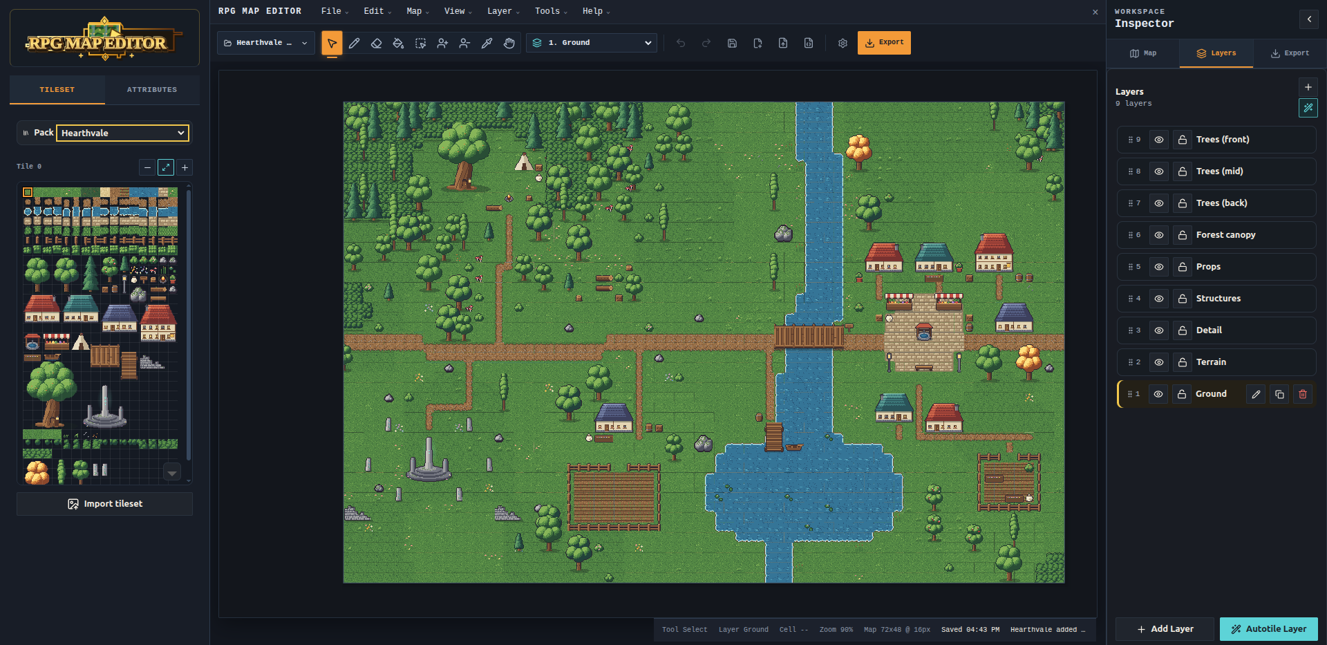
Paint with the pencil or stamp brush, use fill and rectangle tools, and work with autotiling. Separate layers let you organize the map's ground, buildings, vegetation and other details. You can hide, lock and reorder layers instead of flattening the whole project into a finished picture.
Selections provide copy, cut and paste for reusable parts of a map. Reposition a courtyard, duplicate a room, or move an encounter area without painting it again. Map resizing from different anchors helps you expand the part of a layout that needs more space.
The combination matters when a generated layout is almost right. Move a gate, widen an alley or replace a bridge while keeping the rest of the map. Those are normal edits to the native tile project, rather than modifications to a screenshot of the generator output.
Custom tilesets, objects and project files
Import your own tilesets and use multiple atlases in a map. Objects with editable fields can hold the information that turns a visual location into something useful to a game or campaign. Names and notes stay part of the editable project.
Classic supports undo, redo, local drafts, cloud saves in the Online Edition and portable project files with tilesets embedded. Share links give players a route to Classic maps without requiring you to send the original editable project.
For a deeper look at the workflow, visit Classic tile editor features and the battle map editor guide. These tools are particularly useful when the layout of the encounter matters more than geographical simulation.
Experimental game-engine starter exports
Classic's export options include experimental starters for Unity, Godot, Phaser, Cocos, GDevelop, Bevy, LÖVE, Defold and Flame. These bundles provide a starting handoff of map data, tilesets and a loader for the relevant workflow.
They are experimental starter bundles, not official integrations or a guarantee of a complete playable level. Expect to validate the imported result and adapt the loader to your game's needs. World Studio's geographical .rpgmap documents do not use these tilemap exports.
Free generators for cities, regions and dungeons
The free public generators remain available without an account. They are a useful way to try the platform's output, prepare a quick location, or find a starting layout before entering a paid editing workflow.
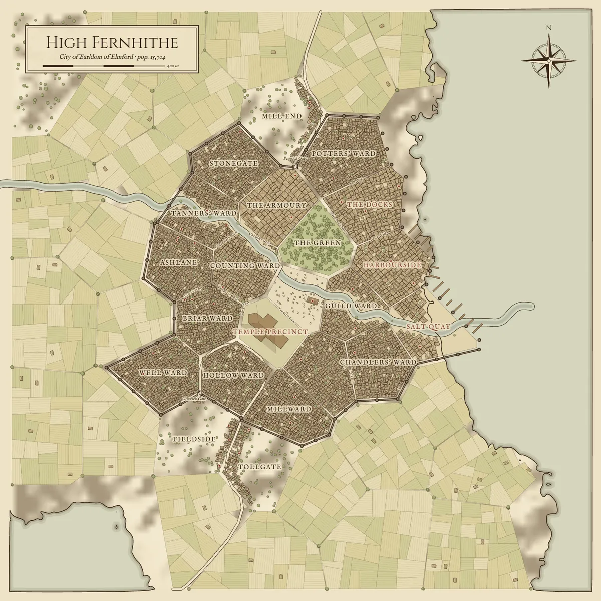
The Fantasy City Generator creates settlements with districts, streets, walls, harbours and named landmarks. Seed, settlement size and setting let you return to a generated layout. Its supported editor handoff makes the result an editable Classic project rather than merely an image you can look at.
The Fantasy Map Generator creates a regional starting map with coasts, rivers, settlements and other geographical details. It supports seeded generation and different landforms and styles. Its Classic editor workflow is separate from the new World Studio editor: the name “world generator” in a tilemap menu does not mean it produces a .rpgmap World Studio document.
The Dungeon Generator provides connected dungeon layouts with themes, loops, a 3D preview, a difficulty heatmap and PNG/JSON output. It is its own utility; do not assume that every generator uses the city and region tools' Classic project handoff.
A sensible preparation sequence is to use World Studio for the campaign region, a city generator for the settlement the party visits, and Classic for the local encounter layout. These can share your worldbuilding decisions while remaining distinct map projects. There is no automatic conversion of a World Studio capital into a detailed city tilemap.
Online Edition, Offline Edition and what you pay for
As checked on October 9, 2026, the site's Online Edition Studio plan displays $3 USD per month. It includes World Studio and the Classic tile editor. World Studio does not require a separate add-on subscription on top of that active Online Edition plan.
The Offline Edition is €14.99 EUR as a one-time purchase for the Classic desktop tile editor. It supports local projects on Windows and Linux, with internet needed for purchase, download, activation and obtaining updates. Ordinary local editing works offline after activation. World Studio is online-only and is not included in that purchase.
| Choice | Payment | Included workflow | Where projects live |
|---|---|---|---|
| Free generators | Free to generate; no account required | Public city, region and dungeon generation tools | Available downloads and supported generator handoffs |
| Online Edition | Currently $3 USD/month | World Studio plus Classic tile editing | Account library, with portable project downloads |
| Offline Edition | €14.99 EUR once | Classic desktop tile editing | Local files on your computer |
The currencies are different because these are different offers. Check current pricing and the Offline Edition page for checkout details, system requirements and the edition you intend to buy. A desktop purchase does not provide a cloud subscription, and the paid editors should not be mistaken for the free public generator tools.
RPGMapEditor.com 2.0 vs other fantasy map makers
The useful comparison is the kind of work you need to do: illustrate a fantasy scene, author a geographical world, edit encounter tiles, model a setting in depth, or deliver walls and lighting to a VTT. Several of these products can coexist in a campaign workflow.
We make RPGMapEditor.com. The following comparisons describe workflow fit, based on our shipped implementation and the linked official competitor documentation accessed on October 9, 2026. They are not independent reviews or a claim that we have benchmarked every competitor. Prices use the vendors' displayed currencies and billing periods; check each source for current checkout and license terms.
| Tool | Documented focus | Payment model | A reason to choose it |
|---|---|---|---|
| RPGMapEditor.com 2.0 | Living world geography plus a separate Classic tile editor | Online currently $3/month; Classic Offline €14.99 once | Generate and reshape a world, use campaign tools, and keep versioned cloud saves |
| Inkarnate | Illustrated world, region, city, battle, scene and isometric maps | Free tier; paid Creator and Studio subscriptions | A broad art catalogue, custom art and community map cloning |
| Wonderdraft | Desktop world-map drawing and generation | $29.99 one-time purchase | Offline world-map work, themes and artistic placement tools |
| Azgaar's Fantasy Map Generator | Procedural geographical and world-building data | Free and open source | Extensive setting layers and editable generated world information |
| Dungeondraft | Desktop encounter maps and dungeons | $19.99 one-time purchase | Dedicated battle-map tools, lighting and Universal VTT export |
| DungeonFog | Browser battle maps and campaign presentation | Free tier; paid Premium and Commercial options | Asset-based encounter maps and campaign mode |
| Watabou's generators | Focused procedural location and region generators | Browser tools with optional creator support | Rapid inspiration for a city, village, region or dungeon |
RPGMapEditor.com 2.0 vs Inkarnate
Inkarnate's official FAQ documents several map categories, including world, city, battle, scene and isometric maps. Its paid plans expand the art catalogue, allow custom assets and provide community map cloning. The Studio tier adds commercial-use capabilities and larger account limits.
Choose Inkarnate when its illustration style, asset selection and community maps are the main draw. Its Free tier also gives you a way to explore the editor before subscribing. Check Inkarnate's current plans rather than relying on old references to its earlier pricing.
RPGMapEditor.com 2.0 is worth considering when your main task is generating and repeatedly reshaping geographical terrain, then using travel planning, Player View and retained cloud versions. Classic adds a separate tilemap workflow in the same account. That makes the choice about how you want to author the world, not simply which homepage shows the prettier map.
RPGMapEditor.com 2.0 vs Wonderdraft
Wonderdraft's official feature list describes generated landmasses, coastline brushes, rivers and roads, grouped tree and mountain placement, map themes and label presets. It is a desktop world-map tool sold for $29.99 once, with offline use and no subscription.
Wonderdraft is a strong option when you want to keep world-map work local and prefer its drawing tools and themes. Its one-time payment is a meaningful difference for someone who edits in bursts between long breaks from a campaign.
World Studio fits a browser-and-cloud workflow with responsive geography, journey planning and a separate Player View. The distinction between editions matters here: RPGMapEditor.com's one-time Offline Edition provides the Classic tile editor, not an offline copy of World Studio. If offline geographical world editing is your requirement, Wonderdraft deserves a close look.
RPGMapEditor.com 2.0 vs Azgaar's Fantasy Map Generator
Azgaar's Fantasy Map Generator is a free, open-source tool with a substantial range of geographical and setting layers. Its official documentation covers terrain, cultures, religions, states, provinces, journeys, military features and other world-building systems. The app also offers SVG and data exports alongside image output.
If you want to explore a setting through extensive political, cultural and demographic information, Azgaar is a compelling choice. The depth of those systems matters more than whether another map editor has a similar-looking coast or a different visual theme.
World Studio emphasizes a focused cartographic editing loop: generate terrain, reshape it directly, tune the presentation, plan a journey and use the map at the table. Its integrated account library and version history are part of that workflow. Procedural generation and editable rivers are not unique claims; the practical question is which interface, output and set of campaign tools suit you.
RPGMapEditor.com 2.0 vs Dungeondraft
Dungeondraft's official product page lists smart tiling, object scattering, landscape painting, lighting, dungeon and cave generation, offline use and Universal VTT export. It is sold for $19.99 once. Its page documents VTT import routes, including Foundry support through a module.
Choose Dungeondraft when your priority is a detailed tactical battle map and its walls-and-lighting handoff to compatible tabletop software. Those are concrete capabilities, rather than an advantage that can be inferred from the size of an art library.
RPGMapEditor.com combines World Studio for regional geography with Classic for editable tile encounters. Its PNG exports can become VTT backgrounds, but it does not provide Dungeondraft's Universal VTT wall-and-light export. For a group whose preparation depends on that workflow, this difference may outweigh the convenience of an integrated world-map editor.
RPGMapEditor.com 2.0 vs DungeonFog
DungeonFog focuses on asset-based battle maps, a vector-based editor, community maps and presentation for play. Its pricing page documents a Free tier, Premium membership, temporary On Demand access and a separate Commercial option, as well as online campaign mode.
DungeonFog is worth investigating when you want its encounter-art workflow and campaign presentation features. Those needs are closer to a battle-map session than to changing the drainage of an entire region.
World Studio concentrates on campaign geography, terrain changes, travel planning and revealing a world map. Classic covers the tile encounter workflow separately. Do not treat World Studio's Player View as a promise of feature parity with DungeonFog's campaign mode; compare the particular play tools your group intends to use.
RPGMapEditor.com 2.0 vs Watabou's generators
Watabou's Medieval Fantasy City Generator and Perilous Shores are useful browser tools for quickly producing evocative cities and regions. Perilous Shores' current release history also documents saving/loading and a blueprint editor, so it would be inaccurate to describe Watabou's work as a collection of uneditable pictures.
Choose these tools when you want a focused generator and like the output it produces. Their individual workflows make them useful sources of location ideas, even if you use another editor for the rest of a campaign.
RPGMapEditor.com's attraction is the connected platform workflow: free generator starting points, native Classic editing for supported outputs, and World Studio's geography, cloud versions and play tools. Its generators are independent implementations, not a claim of affiliation with Watabou or compatibility with every Watabou project format.
A practical workflow: build an island campaign in one session
A feature list is more useful when you can picture the work. Here is a workflow for an island kingdom with a flooded coast, two competing realms and a difficult journey to a ruined tower. The places and story are examples you author, not a promise that a particular seed produces this exact campaign.
- Choose Island and Medium. Start with a contained landmass at the recommended working size. Pick a seed you can record, inspect the preview, and generate the world.
- Set the campaign scale. Decide whether crossing the island should take days or weeks, then adjust the map's scale. This makes the journey estimates relevant to the setting.
- Shape the central ridge. Use Sculpt to raise a range, lower a pass through it, and inspect how the waterways respond. Keep the edit that creates a useful crossing and undo the alternatives.
- Explore the flooded coast. Save a cloud version, then raise sea level to see which coastal areas change. Decide whether the flood is the campaign's present state, a historical event, or a future threat.
- Refine the settlements and realms. Move capitals, rename important places and inspect the territories that result. Add the port, tower or ruins your adventure needs and give them notes.
- Connect the locations. Use roads to plan the main route, then Journey to inspect the distance and terrain. Choose the places where a bridge, pass or exposed stretch makes travel interesting.
- Prepare the player map. Select a style, reduce distracting layers, choose a grid if it helps, and paint the fog you want for the first session. Open Player View on the display or window you will share.
- Save and deliver. Save the finished cloud version, download the
.rpgmapproject, and export a PNG if you need a printed handout or VTT background. Use Classic separately for the tower's tactical encounter map.
This workflow turns a generated starting point into a setting with authored decisions. The time you save on coastlines, drainage and initial placement becomes time you can spend on locations and consequences that the players will care about.
Browser requirements and current limitations
World Studio requires a desktop browser with WebGL2. It is tested in current Chrome and is designed around a mouse or trackpad and keyboard. Firefox, Safari and phone use have not been verified for this release; the editor should not be purchased on the assumption that it is a supported mobile tool.
Performance depends on world size, hardware and the work you are doing. Panning a finished map and repeatedly sculpting terrain are different workloads. Begin with Medium, use Small when you want faster experimentation, and choose Large when you need the extra detail and your computer handles it comfortably.
The geographical recalculation runs in a background worker, but a large edit can still take time to settle. A map that is responsive while you navigate can feel slower during continuous terrain changes. We do not promise a fixed frame rate across computers or world sizes.
The current boundaries are worth keeping in view:
- World Studio needs the online service. Browser drafts provide recovery; they do not turn it into a supported offline desktop edition.
- World Studio and Classic have separate project formats. There is no automatic conversion between a
.rpgmapgeographical world and a tilemap project. - World Studio's exports are PNG and
.rpgmap. It does not supply vector, game-level or VTT walls-and-lighting exports. - Cloud history is retained within limits. The default latest-20 policy and account storage quota are not unlimited historical archiving.
- Player View is a presentation window. It is not simultaneous collaborative editing or a complete virtual tabletop.
- The public generators and paid editors are separate offers. Free generation does not grant free World Studio editing access.
These boundaries make the comparison more useful. A world illustrator, a VTT battle-map author and a developer building tile-based levels may each need a different combination of tools.
Frequently asked questions about RPGMapEditor.com 2.0
Is RPGMapEditor.com 2.0 a free fantasy map generator?
The public city, region and dungeon generators are free to use without an account. World Studio and the online Classic tile editor require active Online Edition access. World Studio is included in that subscription rather than sold as a separate paid add-on.
Can I edit a world after generating it?
Yes. Change terrain, land and sea, climate fields, waterways, roads, landmarks, labels and realm capitals. Geography derived from the editable foundation is recalculated after changes. You can also adjust styles and display layers without regenerating the document.
Does World Studio use generative AI?
World Studio uses deterministic procedural generation for its terrain and map features. It is not an AI image generation service. Seeds describe the generated starting point, and your edited world is saved as a native project.
Is World Studio included in the Offline Edition?
No. The Offline Edition is the Classic tile editor for local desktop projects. World Studio is part of the Online Edition and relies on its account and cloud workflow.
What happens to my existing Classic maps?
They remain Classic projects in your library and continue to open in the Classic editor. World Studio adds a separate world-map workflow; it does not require your existing tile maps to be converted.
Can I share a map with players?
Use World Studio's Player View and fog of war for a revealed campaign map, or export a PNG handout. Classic maps also have their existing share-link workflow. Share the appropriate player-facing window or output instead of the editor containing your GM notes.
Can I use a World Studio map in Foundry VTT or Roll20?
Yes, as an exported PNG background that you import and align in the VTT. That image handoff does not include automatic wall, lighting or scene configuration. Keep the .rpgmap project if you want to edit the original world later.
Can I restore an earlier map version?
Yes, while it remains in the retained cloud history. Restore adds a new head version. The default policy retains the latest 20 saves per world, and you can download retained versions individually.
Does a seed link include everything I edited?
No. A seed reproduces the generated starting point with its settings. Cloud saves and .rpgmap downloads preserve the authored document, including changes made after generation.
Is this the same product as Deepnight's RPG Map Editor 2?
No. RPGMapEditor.com 2.0 is this platform's World Studio release. Deepnight's RPG Map / RPG Map II is a separate tool, and the products are not affiliated.
Choose the mapmaking workflow that fits your campaign
RPGMapEditor.com 2.0 is a useful choice when you want to generate a world, shape its geography, build the campaign's locations around it, and return to that editable setting over time. World Studio provides the geographical editor and play tools; Classic provides the tilemap editor and encounter workflow.
If your immediate priority is a particular illustrated asset catalogue, deep demographic modelling, an offline world-map application, or Universal VTT exports, the comparisons above point to alternatives worth trying. Choose around the work you need to finish, then judge the map you can actually produce.
Start with a free generated city or region if you want to explore the platform's output. When you want editable geographical terrain and the full campaign workflow, open World Studio and make a seed into your own setting.
Open World Studio · See the World Studio feature page · Compare editions · Browse free generators